Search
(+)
cartoon
dealer
buy stock illustrations
Home
My rookie portfolio
📷 Upload yours 🤳
Find results that contain
all
of your keywords. Content filter is
on
. Search will return
stock photos and royalty free images
.
Exclude
Make it so!
You have chosen to exclude "
" from your results.
Choose orientation:
Explore cartoons & images using related keywords:
administrative
belgium
cartography
country
east
flag
geography
illustration
names
north
outline
political
province
region
south
state
travel
west
world
Political Map Of Belgium With Names Royalty-Free Stock Photography
Download
Designed by
Pablofdezr
Title
Political Map of Belgium with Names #77487995
Description
Illustration of a Political Map of Belgium with Names
Belgium Political Map
Belgium maps with markers
Highly detailed editable political map with separated layers. Belgium.
Isolated dotted political map of Belgium
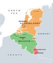
Benelux, Belgium, Netherlands and Luxembourg, single states, political map
Political map of Belgium with borders with borders of regions
High quality political map of Belgium and Netherlands with borde
High quality political map of Belgium, Netherlands and Luxembour
High quality political map of France and Belgium with borders of
Benelux Union member states, Belgium, Netherlands, Luxembourg, political map
Benelux Union countries, Belgium, Netherlands, and Luxembourg, political map