Search
(+)
cartoon
dealer
buy stock illustrations
Home
My rookie portfolio
📷 Upload yours 🤳
Find results that contain
all
of your keywords. Content filter is
on
. Search will return
best illustrations, stock vectors and clipart
.
Exclude
Make it so!
You have chosen to exclude "
" from your results.
Choose orientation:
Explore cartoons & images using related keywords:
asia
atlas
background
cartography
china
coastline
country
destination
east
geography
gray
illustration
island
japan
jejudo
korea
korean
land
map
north
peninsula
political
republic
russia
south
state
travel
white
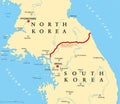
Korean Peninsula Countries Political Map Cartoon Vector
Download
Designed by
Peterhermesfurian
Title
Korean peninsula countries political map #79666373
Description
Korean peninsula countries political map with North and South Korea and national borders. Gray illustration with English labeling and scaling on white background.
Retro color Korean Peninsula Physical Map. No text. Isolated on
Korean Peninsula Physical Map. Retro color
Retro color political map of the Korean Peninsula, Map Of North
Korean Peninsula Map, Map Of North And South Korea
Korean Peninsula Road Map and Navigation Icons, North And South
Korean Peninsula Map in colors of blue and blue map pointers
Korean Peninsula Map Physical Map
Retro color Korean Peninsula Physical Map. No text
Korean Peninsula Detailed Physical Map Isolated on Retro White C
Korean Peninsula political map and map pointers, Map Of North An
Detailed map of Korean Peninsula with infograpchic elements
Korean Peninsula relief map
Korean Peninsula map and Infographics design elements. On white
Korean peninsula, demilitarized zone, political map
Korean Peninsula, Demilitarized Zone Area, gray political map