Search
(+)
cartoon
dealer
buy stock illustrations
Home
My rookie portfolio
📷 Upload yours 🤳
Find results that contain
all
of your keywords. Content filter is
on
. Search will return
best illustrations, stock vectors and clipart
.
Exclude
Make it so!
You have chosen to exclude "
" from your results.
Choose orientation:
Explore cartoons & images using related keywords:
administrative
atlantic
belfast
border
cartography
city
color
country
design
digital
district
europe
european
geography
graphic
illustration
image
ireland
irish
kingdom
lake
map
mapping
modern
north
northern
ocean
outline
political
sea
surface
travel
united
vector
world
Northern Ireland Administrative And Political Map Vector Illustration
Download
Designed by
Lesniewski
Title
Northern ireland administrative and political map #79963200
Description
Northern ireland administrative and political vector map
Northern Ireland
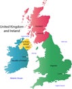
UK and Ireland map
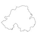
Northern Ireland map
United Kingdom of Great Britain and Northern Ireland contour map
Northern Ireland Map with states and modern round shapes
Northern ireland map vector
Northern Ireland Political Map
Population and Environment Northern Ireland Map
Belfast skyline, Northern Ireland. vector linear
Northern Ireland vector map. UK united great britain ireland map country
Hand drawn map of Northern Ireland and the British Isles.UK-map
Hand drawn map of Northern Ireland and the British Isles
Northern Ireland Outlline Map.
Belfast Northern Ireland city skyline vector silhouette