Search
(+)
cartoon
dealer
buy stock illustrations
Home
My rookie portfolio
📷 Upload yours 🤳
Find results that contain
all
of your keywords. Content filter is
on
. Search will return
best illustrations, stock vectors and clipart
.
Exclude
Make it so!
You have chosen to exclude "
" from your results.
Choose orientation:
Explore cartoons & images using related keywords:
abstract
atlas
background
belgium
benelux
brussels
capital
cartography
country
europe
flanders
france
geography
germany
gray
illustration
land
luxembourg
map
nation
netherlands
political
republic
state
wallonia
white
Belgium And Luxembourg Political Map Cartoon Vector
Download
Designed by
Peterhermesfurian
Title
Belgium and Luxembourg political map #80038459
Description
Belgium and Luxembourg political map with capitals Brussels and Luxembourg, with national borders and neighbor countries. Gray colored illustration with English labeling on white background.
Set 2 Of Football Symbol In National Colors
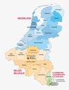
Benelux map
Map of The NETHERLANDISH Lands: The Netherlands, Belgium, Luxembourg (Benelux). Geographic chart.
Belgium Luxembourg summit, meeting or aliance between those two countries that aims at solving political issues, symbolized by a
Joyeux Noel in French. Translated Marry Christmas. France, Switzerland, Belgium, Luxembourg, Andorra and Monaco. French
Highly Detailed Maps of European Countries with Regions on White Background.
Highly detailed blue map of Europe with selected countries, isolated.
Europe vintage illustration map, with regions.
Detailed black map of Europe with countries and regions, isolated.
Highly Detailed Europe Color Map with Countries and Regions Illustrated
Highly Detailed Maps of European Countries with Regions on White Background.
Highly Detailed Map of Western Europe with Regions and Countries Illustrated
Europe vintage illustration map, isolated on white background, high detailed.