Search
(+)
cartoon
dealer
buy stock illustrations
Home
My rookie portfolio
📷 Upload yours 🤳
Find results that contain
all
of your keywords. Content filter is
on
. Search will return
best illustrations, stock vectors and clipart
.
Exclude
Make it so!
You have chosen to exclude "
" from your results.
Choose orientation:
Explore cartoons & images using related keywords:
africa
boundaries
capitals
country
earth
geographical
islands
layers
map
mountains
murals
peaks
physical
river
rivers
saws
seas
valleys
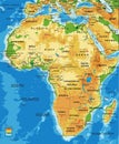
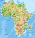
Physical Africa Map Vector Illustration
Download
Designed by
Aintermapa
Title
Physical Africa map #80884180
Description
Country boundaries, country capitals, river courses, names of the main geographical features on earth and see. Information is classified by layers. It is perfect for big murals.
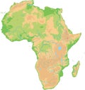
Relief Of Africa.
Africa-physical map
Africa-physical map
Physical Africa Map
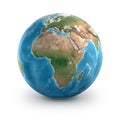
Physical map of the world, satellite view of North and central Africa. Globe. Hemisphere. Reliefs and oceans.
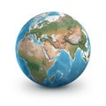
Physical map of the world, satellite view of the Middle East. Africa, Asia. Globe. Hemisphere. Reliefs and oceans.
Physical map of the world, Europe and North Africa. Globe. Hemisphere. Reliefs and oceans
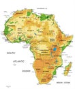
High detailed Africa physical map.
High detailed Africa physical map with labeling.
High detailed Africa physical map.
Physical map of Mediterranean and Central Europe, states and borders, North Africa and the Middle East
Physical map of the Mediterranean Sea, states and borders, North Africa and the Middle East. Mountains, lakes. Israel
Physical earth globe. Europe, Asia and Africa
Physical earth globe. Africa, Middle East and Europe