Search
(+)
cartoon
dealer
buy stock illustrations
Home
My rookie portfolio
📷 Upload yours 🤳
Find results that contain
all
of your keywords. Content filter is
on
. Search will return
best illustrations, stock vectors and clipart
.
Exclude
Make it so!
You have chosen to exclude "
" from your results.
Choose orientation:
Explore cartoons & images using related keywords:
administrative
america
atlas
canada
canadian
city
contour
detail
detailed
district
geographically
geography
illustration
location
map
maple
mayo
political
politically
province
region
silhouette
territory
travel
whitehorse
yukon
Map Of Yukon Vector Illustration
Download
Designed by
Volina
Title
Map of Yukon #82364710
Description
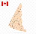
Yukon is the westernmost and smallest of Canada three federal territories
Yukon map - province in western Canada
Yukon flag vector. Civil and state flag of Yukon Territory. Canada
Sticker or label with Mount Logan mountain peak, in Yukon, Canada
Yukon Map
Quill Creek in Kluane National Park and Reserve Yukon Canada WPA Poster Art
Yukon Canada Vintage Travel Poster Postcard
northern lights in yukon canada vintage poster background design
Map of the state or region Yukon (Canada)
The Yukon in northwest Canada
Yukon outline map
Yukon-Koyukuk outline map
yukon province, Canada map. map in black, gray, and outlines
Yukon outline map
Yukon, westernmost territory of Canada, political map
Yukon, westernmost territory of Canada, gray political map