Search
(+)
cartoon
dealer
buy stock illustrations
Home
My rookie portfolio
📷 Upload yours 🤳
Find results that contain
all
of your keywords. Content filter is
on
. Search will return
best illustrations, stock vectors and clipart
.
Exclude
Make it so!
You have chosen to exclude "
" from your results.
Choose orientation:
Explore cartoons & images using related keywords:
administrative
amapa
area
border
borders
brazil
city
counties
countries
country
county
department
departments
design
districts
division
divisions
flat
flats
graphic
illustration
illustrations
map
modern
new
provinces
region
regional
regions
shape
silhouette
simple
state
states
territory
trip
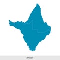
Modern Map - Amapa BR Brazil Stock Photo
Download
Designed by
Werbeantrieb
Title
Modern Map - Amapa BR Brazil #82452180
Description
Modern Map - Amapa BR Brazil Illustration
Brazilian map
Brazilian map with states separated
Amapa Brazil Map black inverted
Amapa map with Brazilian national flag illustration
Amapa red highlighted in map of Brazil
Flag of Amapa from brush strokes. Federal Republic of Brazil. Flag Amapa of Brazil on transparent background for your web site des
Location of Amapa on map Brazil. 3d Amapa location sign similar to the flag of Amapa. Quality map with regions of Brazil. Federal
Flag of Amapa from brush strokes. Blank map of Amapa. Federal Republic of Brazil. High quality map of Amapa
Amapa BRAZIL map with Coronavirus warning illustration
Amapa Brazil map with Social Distancing stayathome tag
Flag of Amapa from brush strokes. Federal Republic of Brazil. Flag Amapa of Brazil on transparent background for your web site d
map of Amapa is a state of Brazil with mesoregions
High Quality map of Macapa is a city of Brazil, with borders of the districts. Map of Macapa city