Search
(+)
cartoon
dealer
buy stock illustrations
Home
My rookie portfolio
📷 Upload yours 🤳
Find results that contain
all
of your keywords. Content filter is
on
. Search will return
best illustrations, stock vectors and clipart
.
Exclude
Make it so!
You have chosen to exclude "
" from your results.
Choose orientation:
Explore cartoons & images using related keywords:
alaska
arctic
atlas
background
baffin
border
canada
cartography
circle
cruise
denmark
earth
english
geography
gray
greenland
iceland
illustration
island
jan
labeling
map
mayen
nation
north
ocean
polar
pole
political
region
russia
scandinavia
sea
siberia
svalbard
travel
vector
white
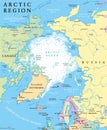
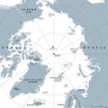
Arctic Region Political Map Vector Illustration
Download
Designed by
Peterhermesfurian
Title
Arctic region political map #82865552
Description
Arctic region political map. Polar region around the North Pole at the northernmost part of Earth. The Arctic Ocean without ice. Gray illustration with English labeling on white background. Vector.
Arctic region with penguin
Arctic Region Political Map
Arctic Region Map
Arctic region single states and North Pole political map
Arctic region countries and North Pole political map
Arctic Region Map
Arctic Region Map and Colorful Map Markers
Arctic Region Map and Navigation Icons
Arctic Region Map. No text
Arctic Region Map Isolated On white
Arctic Region Map and Flat Map Icons
Map of the Arctic region, the northwest passage and the northern sea route
Kobuk Valley National Park in Arctic region of northwestern Alaska United States WPA Poster Art Color
Arctic region, polar region around North Pole, gray political map
family polar bear in the snow in arctic region