Search
(+)
cartoon
dealer
buy stock illustrations
Home
Black Friday
Find results that contain
all
of your keywords. Content filter is
on
. Search will return
best illustrations, stock vectors and clipart
.
Exclude
Make it so!
You have chosen to exclude "
" from your results.
Choose orientation:
Explore cartoons & images using related keywords:
africa
america
americas
antarctica
asia
atlas
australia
blue
borders
business
caption
cartography
colored
continent
country
design
earth
europe
geographical
geography
global
globe
green
illustration
map
multicolored
name
national
north
oceania
oceans
orange
planet
political
red
silhouette
simple
simplified
south
spectral
state
sudan
text
title
travel
vector
violet
world
yellow
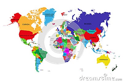
Colored Political World Map With Names Of Sovereign Countries And Larger Dependent Territories. Different Colors For Each Countrie Vector Illustration
Download
Designed by
Stas11
Title
Colored political world map with names of sovereign countries and larger dependent territories. Different colors for each countrie #83885408
Description
Colored political world map with names of sovereign countries and larger dependent territories. Different colors for each countries
Political Physical Topographic Colored World Map Vector
Mountain states in the West region of USA, multi colored political map
Pacific states, West Coast of the USA, multi colored political map
East South Central states in the South region of USA, colored political map
Northeast, U.S. census region, multi colored political map
Midwest, U.S. census region, multi colored political map
West, U.S. census region, multi colored political map
South, U.S. census region, multi colored political map
Germany, states with borders and capitals, multi colored political map
Iowa, U.S. state, subdivided into 99 counties, multi colored political map
Delaware, U.S. state, subdivided into 3 counties, colored political map
Alaska, U.S. state, boroughs and census areas, multi colored political map
Eastern Europe and Western Asia, multi colored political map
The United States of America, multi colored political map