Search
(+)
cartoon
dealer
buy stock illustrations
Home
My rookie portfolio
📷 Upload yours 🤳
Find results that contain
all
of your keywords. Content filter is
on
. Search will return
best illustrations, stock vectors and clipart
.
Exclude
Make it so!
You have chosen to exclude "
" from your results.
Choose orientation:
Explore cartoons & images using related keywords:
above
america
avenue
board
boroughs
broadway
bronx
brooklyn
cartography
city
colored
destinations
downtown
east
equipment
geographical
global
guide
illustration
jersey
journey
label
land
lane
locality
locations
lower
manhattan
map
midtown
navigational
navigator
new
park
pattern
plan
regions
river
road
scheme
straight
street
streets
symbol
tourism
track
travel
usa
vector
view
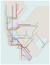
New York Colored Vector Map
Download
Designed by
Max776
Title
New York colored vector map #84711180
Description
New York colored vector map view from above
Colored subway map of New York City
Colored aquarelle sketch of high buildings in New York, the USA. Cityscape big modern city
Crazy New York colored pattern
New york skyline colored with Modern Buildings Isolated on White.
New York skyline hand drawn colored with Modern Buildings Isolated on White.
NYC, New York city t-shirt design with abstract colored print. Brooklyn typography graphics for tee shirt. Vector
Distress New York Badges and Multi-Colored Bacterium New York State Map Mosaic
Grunge New York City Stamp Seals and Multi-Colored Cell New York City Map Collage
New York state counties colored by congressional districts vector map with neighbouring states and terrotories
New York City Renaissance-inspired: Vibrant Colored Houses And Multilayered Perspective
New york city colored retro label. Vector isolated city of New York concept. NYC New York lettering design.
Brownsville, residential neighborhood in eastern Brooklyn in New York City, souvenir composed with multi colored stone letters
New York State economic regions, multi colored political map
New York state map with counties borders and colored congressional districts boundaries
New York, U.S. state, subdivided into 62 counties, multi colored map