Search
(+)
cartoon
dealer
buy stock illustrations
Home
My rookie portfolio
📷 Upload yours 🤳
Find results that contain
all
of your keywords. Content filter is
on
. Search will return
best illustrations, stock vectors and clipart
.
Exclude
Make it so!
You have chosen to exclude "
" from your results.
Choose orientation:
Explore cartoons & images using related keywords:
administrative
area
black
borders
bretagne
caption
counties
country
county
department
departments
design
districts
divisions
flat
flats
france
french
graphic
illustration
isolated
labelled
labels
loire
map
minimal
modern
new
normandie
pays
provinces
region
regional
regions
shape
silhouette
simple
state
states
territory
trip
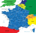
Bretagne - Normandie - Pays De La Loire Map France Royalty-Free Cartoon
Download
Designed by
Werbeantrieb
Title
Bretagne - Normandie - Pays de la Loire Map France #85159949
Description
Bretagne - Normandie - Pays de la Loire Map France illustration
Map of France divided into regions
French Regions
Political map of France
France map
France physical map
Bretagne - Normandie - Paris - Hauts-de-France - Grand Est Map F
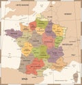
France Map - Vintage Vector Illustration
France map separate region names individual card paper 3D natural blank
Map of The FRENCH Lands: France, Provence, Normandie, Occitanie, Aquitaine, Lorraine. Geographic chart.
Infographics France map, flat design colors, with names of individual states, blue background with orange points
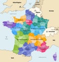
France administrative regions and departments vector map
Flag of Bretagne Brittany
Coat of Arms of Bretagne Brittany
Location Map of Region Normandie