Search
(+)
cartoon
dealer
buy stock illustrations
Home
Black Friday
Find results that contain
all
of your keywords. Content filter is
on
. Search will return
best illustrations, stock vectors and clipart
.
Exclude
Make it so!
You have chosen to exclude "
" from your results.
Choose orientation:
Explore cartoons & images using related keywords:
administrative
america
area
black
border
borders
caption
city
counties
countries
country
county
department
departments
design
districts
division
divisions
flat
flats
graphic
illinois
illustration
illustrations
iowa
isolated
kansas
labelled
labels
map
modern
nebraska
new
provinces
region
regional
regions
shape
silhouette
simple
state
states
territory
trip
united
usa
Did you mean
Black Friday
?
Cyber Monday
perhaps ?
...or Nebraska - Kansas - Iowa - Illinois Map Labelled Black Royalty-Free Illustration
Download
Designed by
Werbeantrieb
Title
Nebraska - Kansas - Iowa - Illinois Map labelled black #85346418
Description
Nebraska - Kansas - Iowa - Illinois Map labelled black illustration
Kansas map
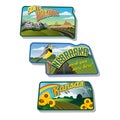
Luggage stickers South Dakota Nebraska Kansas
Nebraska - Kansas - Oklahoma - Iowa Map labelled black
Nebraska, NE, political map, US state, nicknamed Cornhusker State
Little bluestem Schizachyrium scoparium , state grass of of Nebraska and Kansas
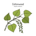
Eastern cottonwood populus deltoides , the official state tree of Kansas
Little bluestem Schizachyrium scoparium , state grass of of Nebraska and Kansas
Glossy glass of Pawnee Nation of Oklahoma
Glossy glass Flag of Nebraska July 16, 1963
Nebraska, Iowa, Kansas city lights
Midwest region. West North Central: Iowa, Kansas, Minnesota, Missouri, Nebraska, North Dakota, South Dakota. States of America
West North Central states in the Midwest region of USA, multi colored map