Search
(+)
cartoon
dealer
buy stock illustrations
Home
My rookie portfolio
📷 Upload yours 🤳
Find results that contain
all
of your keywords. Content filter is
on
. Search will return
best illustrations, stock vectors and clipart
.
Exclude
Make it so!
You have chosen to exclude "
" from your results.
Choose orientation:
Explore cartoons & images using related keywords:
adorable
animals
beef
carrack
cartoon
characteristics
coconut
condor
continent
cute
design
doodle
earth
easter
education
fauna
fish
football
funny
galapagos
geography
global
history
illustration
inca
island
jesus
lama
lungs
machu
map
mountain
nature
object
ocean
parrot
picchu
rainforest
rio
sea
soccer
society
statue
swordfish
toucan
turtle
vector
whale
wildlife
Illustrated Map Of South America Cartoon Vector
Download
Designed by
Vook777
Title
Illustrated Map of South America #88366557
Description
Illustrated Map of South America. With funny and typical objects, people, activities, animals, plants, history etc. Illustration in eps10 vector, continent on separate layer.
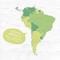
Colorfully vector hand illustrated map of South America.
Animal map for kid. World vector poster for children, cute illustrated
Illustrated Colorfull Map of North and South America
Map of South East Asia, drawn illustrated brush strokes, geographical map, physics. Cartography, geographical atlas.
Illustrated pictorial map of Midwest United States.
Illustrated pictorial map of South central United States.
Illustrated Map of South America with fun hand drawn characters, plants and elements. Cartoon color vector illustration
Illustrated design of the symbol of the hand and the South African Flag to commemorate the day of the youth of June 16
South Korea outline doodle illustrated map. The most famous Korean landmarks, temples and buildings.
South Korea outline doodle illustrated map. famous Korean landmarks, symbols and buildings.
Vector illustrated map of South Africa with provinces and administrative divisions, and neighbouring countries
Vector illustrated blank map of South Africa with provinces and administrative divisions, and neighbouring countries
Vector illustrated map of South Korea with provinces, metropolitan cities and administrative divisions, and neighbouring countries
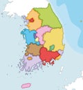
Vector illustrated blank map of South Korea with provinces and administrative divisions, and neighbouring countries
Digital Connectivity and Information Exchange in South America: A Network Concept Illustrated