Search
(+)
cartoon
dealer
buy stock illustrations
Home
My rookie portfolio
📷 Upload yours 🤳
Find results that contain
all
of your keywords. Content filter is
on
. Search will return
best illustrations, stock vectors and clipart
.
Exclude
Make it so!
You have chosen to exclude "
" from your results.
Choose orientation:
Explore cartoons & images using related keywords:
americas
antilles
atlas
brac
british
capital
caribbean
cartography
cayman
caymans
cruise
destination
english
geography
george
georgetown
grand
gray
illustration
islands
kingdom
labeling
lesser
little
map
overseas
political
sea
territory
town
travel
united
vector
Cayman Islands Political Map Cartoon Vector
Download
Designed by
Peterhermesfurian
Title
Cayman Islands political map #89654283
Description
Cayman Islands political map with capital George Town. British Overseas Territory. Three islands in the western Caribbean Sea. Gray illustration on white background. English labeling. Vector.
Cayman Islands map
Cayman Islands Political Map
Flag of Cayman Islands button
Coat of arms of Cayman Islands
Cayman islands highly detailed physical map
Cayman Islands outline map
Gran Caiman Island. Cayman Islands. Location diagram. Yellow
Gran Caiman Island. Cayman Islands. Shape on white. Bilevel
Gran Caiman Island. Cayman Islands. Shape on white. Topo standard
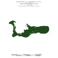
Gran Caiman Island, Cayman Islands, cropped to square. Physical
Shape of Gran Caiman Island. Cayman Islands. Yellow
Gran Caiman Island, Cayman Islands, cropped to square. Bilevel
Cayman Islands Britain old travel plate
Gran Caiman Island. Cayman Islands. Shape on white. Physical