Search
(+)
cartoon
dealer
buy stock illustrations
Home
My rookie portfolio
📷 Upload yours 🤳
Find results that contain
all
of your keywords. Content filter is
on
. Search will return
best illustrations, stock vectors and clipart
.
Exclude
Make it so!
You have chosen to exclude "
" from your results.
Choose orientation:
Explore cartoons & images using related keywords:
abstract
america
american
background
blue
capitals
cartography
city
clime
concept
continent
country
design
digitally
earth
geography
geometric
global
glowing
graphic
grenadines
hemisphere
illustration
international
isolated
journey
kingstown
land
landmark
landmass
lines
modern
mosaic
north
official
polygonal
republic
saint
sign
stars
symbol
triangle
vincent
white
world
worldwide
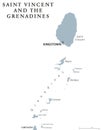
Map Of Saint Vincent And The Grenadines From Polygonal Blue Lines, Glowing Stars Illustration Royalty-Free Cartoon
Download
Designed by
Elenvd
Title
Map of Saint Vincent and the Grenadines from polygonal blue lines, glowing stars illustration #92509919
Description
Map of Saint Vincent and the Grenadines from polygonal blue lines and glowing stars illustration
Saint Vincent and the Grenadines 3d Golden Map
Saint Vincent and the Grenadines Political Map
Saint Vincent and the Grenadines political map
Saint Vincent and the Grenadines - vector map
Saint Vincent and the Grenadines outline map
Saint Vincent Island. Saint Vincent and the Grenadines. Location diagram. Yellow
Saint Vincent Island. Saint Vincent and the Grenadines. Shape on white. Bilevel
Saint Vincent Island. Saint Vincent and the Grenadines. Topo Humanitarian
Saint Vincent Island. Saint Vincent and the Grenadines. Physical
Saint Vincent Island, Saint Vincent and the Grenadines, cropped to square. Physical
Shape of Saint Vincent Island. Saint Vincent and the Grenadines. Yellow
Saint Vincent Island. Saint Vincent and the Grenadines. Bilevel
Saint Vincent Island, Saint Vincent and the Grenadines, cropped to square. Bilevel
Saint Vincent Island. Saint Vincent and the Grenadines. Topo standard