Search
(+)
cartoon
dealer
buy stock illustrations
Home
My rookie portfolio
📷 Upload yours 🤳
Find results that contain
all
of your keywords. Content filter is
on
. Search will return
best illustrations, stock vectors and clipart
.
Exclude
Make it so!
You have chosen to exclude "
" from your results.
Choose orientation:
Explore cartoons & images using related keywords:
administrative
america
american
americas
atlas
background
barnstable
berkshire
border
boston
boundary
bristol
cambridge
city
color
colorful
contour
counties
country
county
dedham
detail
detailed
district
dukes
edgartown
essex
franklin
geography
gradient
greenfield
hampden
hampshire
illustration
isolated
maine
map
massachusetts
middlesex
national
norfolk
province
seat
springfield
state
suffolk
travel
united
usa
vector
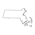
Map Of Massachusetts State Vector Illustration
Download
Designed by
Indos82
Title
Map of Massachusetts state #9291456
Description
Map of Massachusetts state designed in illustration with the counties and the county seats. (Map is hight resolution)
Map of Massachusetts state
Massachusetts State by counties
Massachusetts State Interstate Map
Map of the U.S. state Massachusetts
Massachusetts State House, Boston
Hand Drawn Massachusetts State Design
Massachusetts, state of USA - solid black silhouette map of country area. Simple flat vector illustration
Massachusetts State Highway road sign
Massachusetts MA State Border USA Map Outline
Doodle vector map of Massachusetts state of USA
3d Map of Massachusetts state with color. United State of America, US, United State
High detailed illustration map - solid Massachusetts State Map