Search
(+)
cartoon
dealer
buy stock illustrations
Home
My rookie portfolio
📷 Upload yours 🤳
Find results that contain
all
of your keywords. Content filter is
on
. Search will return
best illustrations, stock vectors and clipart
.
Exclude
Make it so!
You have chosen to exclude "
" from your results.
Choose orientation:
Explore cartoons & images using related keywords:
area
border
british
cartography
contour
country
geography
graphic
icon
illustration
islands
land
map
nation
national
navigation
outline
shape
silhouette
travel
vector
virgin
world
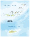
British Virgin Islands Map Cartoon Vector
Download
Designed by
Parkheta
Title
British Virgin Islands map #95435027
Description
British Virgin Islands map on the white background. Vector illustration
British Virgin Islands map
British Virgin Islands Political Map
British Virgin Islands map
British Virgin Islands watercolor map in front of a white background
British Virgin Islands rubber stamp
Virgin Islands UK Flag
Tortola British Virgin Islands
United states and british virgin islands vector map
Tortola Island, British Virgin Islands, cropped to square. Topo standard
Anegada Island, British Virgin Islands, cropped to square. Physical
Tortola Island, British Virgin Islands, cropped to square. Physical
Anegada Island. British Virgin Islands. Shape on white. Physical
Breathtaking TiltShift Perspective of the British Virgin Islands A Stunning Aerial Panorama Unveiling the Archipelagos
Discover the Enchanting Baths at the British Virgin Islands A Tropical Paradise of Stunning Rock Formations
Breathtaking Aerial View of Anegada British Virgin Islands Pristine Beaches and Coral Reefs Unveiled