Search
(+)
cartoon
dealer
buy stock illustrations
Home
My rookie portfolio
📷 Upload yours 🤳
Find results that contain
all
of your keywords. Content filter is
on
. Search will return
best illustrations, stock vectors and clipart
.
Exclude
Make it so!
You have chosen to exclude "
" from your results.
Choose orientation:
Explore cartoons & images using related keywords:
alabama
america
atlas
background
canaveral
cape
capital
caribbean
cartography
cruise
destination
english
florida
fort
geography
georgia
gray
gulf
illustration
keys
labeling
lauderdale
map
mexico
miami
orlando
peninsula
political
state
states
tallahassee
tampa
travel
united
usa
vector
white
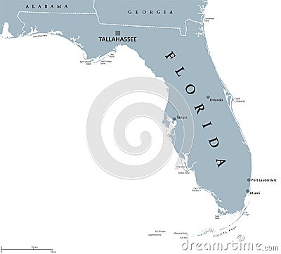
Florida United States Political Map Vector Illustration
Download
Designed by
Peterhermesfurian
Title
Florida United States political map #96612198
Description
Florida political map with capital Tallahassee. State in the southeastern region of the United States, bordered by the Gulf of Mexico. Gray illustration on white background. English labeling. Vector.
Miami Florida United States Abstract Skyline City
Stamp Welcome to Florida, United States
Stamp with the name and map of Florida, United States
Business concept with handshake and the text Welcome to Florida, United States
Illustrated pictorial map of Southern United States.
The Bridge of Lions, Florida, United States
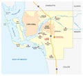
Lee County Map with Fort Myers and Cape Coral, Florida, United States
Collage about Ft. Lauderdale, Florida, United States
A Flamingo Wading in Subtropical Wilderness of Everglades National Park Florida United States Mono Line or Monoline Black and
Vector road map of Tampa Bay Area, Florida, United States
Administrative map of Tampa Bay area, Florida, United States
Tampa Bay area, Florida, United States, colored political map
Map of the state or region Florida (United States)
Map of the state or region Florida (United States of America)
Map of Anna Maria Island, Florida, United States