Search
(+)
cartoon
dealer
buy stock illustrations
Home
My rookie portfolio
📷 Upload yours 🤳
Find results that contain
all
of your keywords. Content filter is
on
. Search will return
best illustrations, stock vectors and clipart
.
Exclude
Make it so!
You have chosen to exclude "
" from your results.
Choose orientation:
Explore cartoons & images using related keywords:
agana
archipelago
area
atlas
background
capital
cartography
cnmi
commonwealth
destination
english
geography
gray
guam
hagatna
illustration
insular
island
islands
labeling
land
map
mariana
northern
ocean
pacific
pagan
political
rota
saipan
states
tinian
travel
united
vector
white
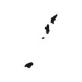
Northern Mariana Islands Political Map Vector Illustration
Download
Designed by
Peterhermesfurian
Title
Northern Mariana Islands political map #96920960
Description
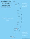
Northern Mariana Islands political map with capital Saipan. Insular area and commonwealth of the United States in the Pacific Ocean. Gray illustration on white background. English labeling. Vector.
Northern Mariana Islands 3d Golden Map
Northern Mariana Islands road sign.
Northern Mariana Islands political map
Northern Mariana Islands Coronavirus Typography. COVID-19 country banner
Blank map of Northern Mariana Islands. High quality map of Northern Mariana Islands with provinces on transparent background
Coat of arms of the Northern Mariana Islands. USA.
Commonwealth of the Northern Mariana Islands United States of America, USA, Mariana Archipelago map vector illustration,
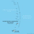
Guam and Northern Mariana Islands, unincorporated US territories, political map
Simplified silhouette of Northern Mariana Islands border
Saipan and Tinian, Northern Mariana Islands, political map
Saipan and Tinian, Northern Mariana Islands, gray political map
Guam and Northern Mariana Islands, US territories, gray political map
Road map of the island of Saipan, Northern Mariana Islands, United States
map of the islands Saipan, Tinian, Rota, Northern Mariana Islands