Search
(+)
cartoon
dealer
buy stock illustrations
Home
My rookie portfolio
📷 Upload yours 🤳
Find results that contain
all
of your keywords. Content filter is
on
. Search will return
best illustrations, stock vectors and clipart
.
Exclude
Make it so!
You have chosen to exclude "
" from your results.
Choose orientation:
Explore cartoons & images using related keywords:
archipelago
atlas
babeldaob
babelthuap
background
belau
capital
caroline
cartography
country
destination
english
geography
gray
illustration
island
islands
labeling
map
micronesia
ngerulmud
ocean
pacific
palau
pelew
political
republic
travel
vector
white
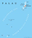
Palau Political Map Vector Illustration
Download
Designed by
Peterhermesfurian
Title
Palau political map #96921258
Description
Palau political map with capital Ngerulmud. Republic and island country in the Pacific Ocean. Part of Caroline Islands in Micronesia. Former Belau or Pelew. Gray illustration. English labeling. Vector
Palau Political Map
Vector Halftone Pattern and Solid Map of Palau Islands
Carcass Map of Palau Islands
Blue Star Palau Map Composition and Scratched Stamp
Vector Spectrum Gradient Pixel Map of Palau Islands
Palau flag and United States of America flag on two puzzle pieces on white isolated background. The concept of political relations
Palau flag and China of America flag on two puzzle pieces on white isolated background. The concept of political relations. 3D
Vote in Palau
Map of Republic of Palau on political world map with magnifying glass
Palau Map Vector New 2024 Colorful - Customizable layered political map of Palau with administrative divisions for website,
Palau Map Vector Vintage Dark Blue Beige - Customizable layered political map of Palau with administrative divisions for website,
Palau Map Vector Blue Spot - Customizable layered political map of Palau with administrative divisions for website, education,
Flag of Australia and Palau. Two Flag Together