Search
(+)
cartoon
dealer
buy stock illustrations
Home
My rookie portfolio
📷 Upload yours 🤳
Find results that contain
all
of your keywords. Content filter is
on
. Search will return
best illustrations, stock vectors and clipart
.
Exclude
Make it so!
You have chosen to exclude "
" from your results.
Choose orientation:
Explore cartoons & images using related keywords:
administrative
america
areas
atlas
borders
boundary
button
california
chinatown
country
districts
divisions
dolores
flag
franciscan
francisco
lakeside
map
midtown
mission
neighborhoods
portola
regions
san
sunset
terrace
usa
vector
Map Of San Francisco With Districts Vector Illustration
Download
Designed by
Sateda
Title
Map of San Francisco with Districts #99090430
Description
Vector map of San Francisco with named districts and travel icons
San Francisco city map with neighbourhoods grey illustration silhouette shape
San Francisco map with American national flag illustration
San Francisco Map with neighborhoods and modern round shapes
San Francisco city map grey illustration silhouette shape
San Francisco city map USA labelled black illustration
Map of California with Regions
Ecuador higt detailed map with subdivisions. Administrative map of Ecuador with districts and cities name, colored by states and
El Salvador higt detailed map with subdivisions. Administrative map of El Salvador with districts and cities name, colored by
Honduras higt detailed map with subdivisions. Administrative map of Honduras with districts and cities name, colored by states and
City Skyline 2 Horizontal Banners Set
Sunrise at Golden Gate Bridge, San Francisco, CA
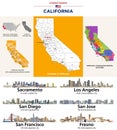
California\'s counties map and congressional districts map. State\'s largest cities skylines
California state map with counties borders and colored congressional districts boundaries
Unveiling a Dreamlike Castro District San Franciscos Surreal Architecture and Vibrant Colors in a Stunning Photographic