Search
(+)
cartoon
dealer
buy stock illustrations
Home
My rookie portfolio
📷 Upload yours 🤳
Find results that contain
all
of your keywords. Content filter is
on
. Search will return
best illustrations, stock vectors and clipart
.
Exclude
Make it so!
You have chosen to exclude "
" from your results.
Choose orientation:
Related commercial searches:
nazi
germany
third
reich
greatest
extent
jaundice
icterus
baby
german
text
turkey
ottoman
empire
wwii
aztec
maximal
tributary
provinces
history
map
error
energy
dolphin
graffiti
triple
alliance
1519
limit
Page
of 93
←
→
Order by:
relevancy of keywords
|
publishing date
|
most downloaded
Extent
Cartoons, Illustrations & Vector Stock Images
- 2502 images
Nazi Germany Third Reich Greatest Extent
Extent of Jaundice icterus with Baby
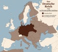
Third Reich Nazi Germany Greatest Extent German Text
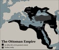
Turkey Ottoman Empire Greatest Extent
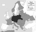
Nazi Germany WWII Greatest Extent
Aztec Empire maximal extent with tributary provinces, history map
Extent, error, energy and dolphin graffiti
The Aztec Empire, map of the Triple Alliance and maximal extent in 1519
Limit Word Displays Confines Boundary Or Extent
After-fire survey of a burnt forest, documenting the extent of damage for environmental recovery plans
Swarm of firefighting drones surveying raging wildfires, analyzing heat patterns, wind directions, and damage extent to
landscape of the North Pole where climate change has caused melting ice caps and reduced polar ice extent Creative AI
East Yorkshire Crops Suffer Devastating Wind and Rain Damage Double Exposure Shows Extent of Wheat and Corn Field
Global Map Highlighting Areas Affected by Ransomware, Demonstrating the Extent of Cyber Attacks
Mix icon for Scope, extent and range
Wide extent USA America Mexico HD Satellite image NASA
Mix icon for Increasingly, more and extent
Black solid icon for Scope, extent and range
Mix icon for Extent, limit and range
Black line icon for Extent, limit and zone
Black solid icon for Extent, limit and range
Black solid icon for Ranges, spectrum and extent
Color illustration icon for Extent, limit and range
Color illustration icon for Scope, extent and range
Next Page
←
↑
↓
→
See more images