Search
(+)
cartoon
dealer
buy stock illustrations
Home
My rookie portfolio
📷 Upload yours 🤳
Find results that contain
all
of your keywords. Content filter is
on
. Search will return
stock photos and royalty free images
.
Exclude
Make it so!
You have chosen to exclude "
" from your results.
Choose orientation:
Related commercial searches:
geoinformatics
geospatial
analysis
conceptual
illustration
digital
elevation
model
quarry
gis
usage
mine
steep
walls
topographic
excavation
site
stockpiles
aggregates
hole
Page
of 3
←
→
Order by:
relevancy of keywords
|
publishing date
|
most downloaded
Georeferencing
Stock Photos, Royalty-Free Images
- 69 images
Geoinformatics and Geospatial Analysis - Conceptual Illustration
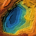
Digital elevation model of a quarry for GIS usage
Digital elevation model of a mine with steep walls
Digital topographic elevation model of a excavation site with steep walls
Digital topographic elevation model of a stockpiles of aggregates with steep walls
Digital topographic elevation model of a excavation hole with steep walls
Digital topographic elevation model of a excavation site with steep walls
Digital elevation model of a mine with steep walls
Digital elevation model of a mine machinery
Digital topographic elevation model of a excavation site with steep walls
Digital elevation model of a quarry
DEM digital elevation model. GIS lidar product made after proccesing aerial pictures taken from a drone by mapping
Digital topographic elevation model of a excavation site with steep walls
DEM digital elevation model. GIS lidar product made after proccesing aerial pictures taken from a drone by mapping
Next Page
←
↑
↓
→
See more images