Search
(+)
cartoon
dealer
buy stock illustrations
Home
My rookie portfolio
📷 Upload yours 🤳
Find results that contain
all
of your keywords. Content filter is
on
. Search will return
best illustrations, stock vectors and clipart
.
Exclude
Make it so!
You have chosen to exclude "
" from your results.
Choose orientation:
Related commercial searches:
leaning
landforms
kids
collection
educational
labeled
formation
examples
scenery
3d
isometric
flat
vector
conceptual
illustration
inland
relief
major
karst
cycle
erosion
word
search
puzzle
detailed
map
fragmented
learning
barrier
island
system
as
dune
type
coastal
outline
Page
of 158
←
→
Order by:
relevancy of keywords
|
publishing date
|
most downloaded
Landforms
Cartoons, Illustrations & Vector Stock Images
- 4265 images
Leaning Landforms for kids
Landforms
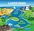
Landforms collection with educational labeled formation examples scenery
3D Isometric Flat Vector Conceptual Illustration of Landforms
Inland relief
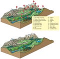
Major Landforms
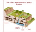
The Karst Landforms and Cycle of Erosion
Landforms
Landforms word search puzzle
Detailed map illustration of fragmented landforms
Vector illustration of a Learning Landforms for kids
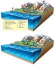
Barrier island system as dune type and coastal landforms outline diagram
Landforms
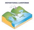
Depositional landforms and sediment created relief area types outline diagram
Large group of isolated objects theme - landforms
Collection of illustrated floating landforms featuring diverse terrains. Includes
Antique-style map featuring fictional landforms and names, including \"Gonis Ocean\"
Topographical view of planetary surfaces and landforms imagery
3D topographic map of Europe, showing mountains, coastlines, and landforms
Beige 3D Relief Map of Imaginary World with Detailed Landforms and Structures
An antique-style map with ornate details and fictional landforms. It features hand
Stunning Desert Landscapes Unveiled A DronesEye View of Three Dramatic Landforms
Detailed Topographic Map of Southern Africas Coastline Exploring Elevation Relief and Landforms
High Resolution Globe View Showing Africa Europe And Middle East with Blue Oceans And Desert Landforms
Aerial LiDAR GIS map of a desert canyon highlighting elevation gradients erosion and unique landforms in 3D.
Next Page
←
↑
↓
→
See more images