Search
(+)
cartoon
dealer
buy stock illustrations
Home
My rookie portfolio
📷 Upload yours 🤳
Find results that contain
all
of your keywords. Content filter is
on
. Search will return
best illustrations, stock vectors and clipart
.
Exclude
Make it so!
You have chosen to exclude "
" from your results.
Choose orientation:
Related commercial searches:
map
united
states
split
census
regions
divisions
vector
bureau
designated
population
conception
2020
america
banner
starburst
people
flag
process
collecting
analyzing
demographic
data
illustration
american
Page
of 144
←
→
Order by:
relevancy of keywords
|
publishing date
|
most downloaded
Census
Cartoons, Illustrations & Vector Stock Images
- 3875 images
Map of United States split into Census regions and divisions
Vector map of the United States census bureau designated regions and divisions
Census of population. conception
Census 2020 United States of America
2020 Census Banner Starburst
2020 Census Banner with People and Flag
Census 2020. The process of collecting and analyzing population demographic data.
United States Population Census 2020 banner. Vector illustration with American striped flag and stars. Can be used for landing
USA People Map. Map of the United States Made Up of a Crowd of People Icons
State of Washington, census regions, multi colored political map
Alaska, U.S. state, political map, subdivided into boroughs and census areas
United States divided in Census regions and divisions, gray map
United States, Census regions and divisions, political map
Midwest, census region of the United States, gray political map
Northeast, census region of the United States, gray political map
Census questionnaire abstract concept vector illustration.
Filling census form online abstract concept vector illustration.
United States, split into Census regions and divisions, political map
Alaska, U.S. state, boroughs and census areas, multi colored political map
West, census region of the United States, gray political map
South, census region of the United States, gray political map
Midwest, U.S. census region, multi colored political map
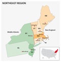
Administrative vector map of the US Census Region Northeast
A desk with a wooden block CENSUS word text
A wooden surface, with wooden blocks of word text census
West, U.S. census region, multi colored political map
Next Page
←
↑
↓
→
See more images