Search
(+)
cartoon
dealer
buy stock illustrations
Home
My rookie portfolio
📷 Upload yours 🤳
Find results that contain
all
of your keywords. Content filter is
on
. Search will return
best illustrations, stock vectors and clipart
.
Exclude
Make it so!
You have chosen to exclude "
" from your results.
Choose orientation:
Related commercial searches:
vector
set
ceast
european
cities
skylines
flat
landscapes
illustration
london
paris
new
york
design
landmarks
detailed
world
map
borders
countries
twin
usa
skyline
silhouette
smart
grid
buildings
isometric
illustrations
traveling
around
Page
of 741
←
→
Order by:
relevancy of keywords
|
publishing date
|
most downloaded
Cities
Cartoons, Illustrations & Vector Stock Images
- 81068 images
Vector set of ceast european cities
Cities skylines set. Flat landscapes vector illustration. London, Paris and New York cities skylines design with landmarks
Detailed world map with borders, countries and cities
Twin cities USA skyline and landmarks silhouette
Smart grid cities and buildings isometric vector illustrations
Traveling around the world. Cities skylines set. Flat landscapes of London, Paris, New York and Delhi with landmarks
Twin Cities skyline, monochrome silhouette.
Physical World Map vector illustration with cities, countries and international borders
Smart cities
Ecology.Green cities help the world,earth with eco-friendly concept ideas.vector illustration
Ecology.Green cities help the world with eco-friendly concept ideas.vector illustration
Power of china, energy beam on Beijing. dark map with illuminated cities and human density areas. 3d illustration
The green world and green cities ECO Concept. Generative Ai
States capitals and major cities of the United States of America. Beautiful modern graphic USA map.
Vector set of Baltic and Scandinavian countries` cities skylines: Copenhagen, Stockholm, Oslo, Reykjavik, Helsinki, Riga, Tallinn,
Apocalyptic city illustration
USA Map
Environment, smart cities and sustainability tag cloud
Highly detailed road map of United States and colorful map point
Smart home and internet of things concept. Cloud computing to connect global wireless devices with each other.
Megacities of the World, political map
Future renewable energy solution for sustainable cities.
Smart green cities consume alternative natural energy sources with advanced intelligent services, social networks
Set of thin lines different cities for travel destinations. Landmarks banner template of flyer, magazines, posters, book
Drawing Australian cities. Sketch of city.
France map with largest cities skylines silhouettes vector set
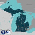
Map of state Michigan, USA
Next Page
←
↑
↓
→
See more images