Search
(+)
cartoon
dealer
buy stock illustrations
Home
My rookie portfolio
📷 Upload yours 🤳
Find results that contain
all
of your keywords. Content filter is
on
. Search will return
best illustrations, stock vectors and clipart
.
Exclude
Make it so!
You have chosen to exclude "
" from your results.
Choose orientation:
Related commercial searches:
continental
drift
planet
earth
chronological
movement
historical
timeline
continents
pangaea
laurasia
gondwana
mainlands
different
periods
250
mya
to
present
vector
changes
map
colorful
illustration
worldmap
permian
jurassic
paleogen
classic
vintage
retro
legendary
sport
car
lincoln
Page
of 741
←
→
Order by:
relevancy of keywords
|
publishing date
|
most downloaded
Continental
Cartoons, Illustrations & Vector Stock Images
- 21347 images
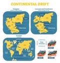
Continental drift
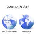
Continental drift on the planet Earth
Continental drift chronological movement, historical timeline with earth continents: Pangaea, Laurasia, Gondwana.
Continental drift. The movement of mainlands on the planet Earth in different periods from 250 MYA to Present. Vector
Continental drift and changes of Earth map. Colorful vector illustration of Worldmap at Permian, Jurassic, Paleogen and
Classic vintage retro legendary sport car Lincoln
Continental worldmap
Bentley Continental SS (2010)
Bentley Continental 1950s
Bentley Continental R
Bentley Continental SS (2010)
Logo Continental
Bentley Continental GT V8 S Vector
Bentley Continental SS (2010)
Continental plates-divergence
Continental drift on the planet Earth
Bentley Continental SS (2010)
Pangaea maps with modern continental borders, and Superocean Panthalassa
Continental-oceanic crust.ai
Map of Pangaea on globe with modern continental borders
Convergent plate boundary created by two continental plates that slide towards each other
Tectonic plate earth map. Continental ocean pacific, volcano lithosphere geography plates
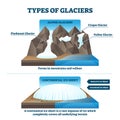
Type of glaciers vector illustration. Labeled alpine or continental example
Tectonic plate earth map. Continental ocean pacific, volcano lithosphere geography plates
Maps Laurasia and Gondwana, continental borders, and ocean Tethys
Next Page
←
↑
↓
→
See more images