Search
(+)
cartoon
dealer
buy stock illustrations
Home
My rookie portfolio
📷 Upload yours 🤳
Find results that contain
all
of your keywords. Content filter is
on
. Search will return
best illustrations, stock vectors and clipart
.
Exclude
Make it so!
You have chosen to exclude "
" from your results.
Choose orientation:
Related commercial searches:
bosporus
dardanelles
turkish
straits
political
map
gray
troy
lesbos
aerial
cove
view
white
cliffs
turquoise
waters
sailboat
marvel
canakkale
1915
bridge
spanning
strait
breathtaking
panoramic
turkeys
historical
majestic
perspective
architectural
wonder
Page
of 5
←
→
Order by:
relevancy of keywords
|
publishing date
|
most downloaded
Dardanelles
Cartoons, Illustrations & Vector Stock Images
- 133 images
Bosporus and Dardanelles, the Turkish Straits, political map
Bosporus and Dardanelles, the Turkish Straits, gray political map
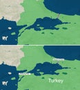
Map of Dardanelles, Troy and Lesbos
Aerial Cove View - White Cliffs, Turquoise Waters & Sailboat in Dardanelles
Marvel at the Canakkale 1915 Bridge Spanning the Dardanelles Strait A Breathtaking Panoramic View of Turkeys Historical
Majestic Canakkale Bridge An Aerial Perspective of Turkeys Architectural Wonder Spanning the Dardanelles Strait
The map of Bosphorus and Dardanelles Strait with text, textless
Zoom in to the map of Bosporus and Dardanelles Strait with text, textless
One world war Gallipoli - Canakkale 1915 Turkey
Black Sea region, with Crimea and Sea of Azov, gray political map
Black Sea region, with Crimea, Sea of Azov, and Sea of Marmara, political map
Bozcaada Sunset A Silhouette Symphony of Colors in a Narrow Canakkale Alleyway
Map Of Turkey
Turkey map
Turkey physical map
Turkey political map
Turkey Political Map
Türkiye, Turkey political map with capital Ankara
Map of The GREEK Lands: Greece, Peloponnese, Thrace, Macedonia, Balkans, Aegean Sea. Geographic chart.
One world war Gallipoli - Canakkale 1915 Turkey
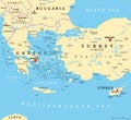
Aegean Sea region, with Aegean Islands, gray political map
Black sea map
Turkey and Syria region, geographic area of Anatolia, gray political map
Aegean Sea region, with Aegean Islands, political map
Turkey
Mediterranean Sea subdivisions, political map, with the Black Sea
Map of The BLACK SEA basin: Black Sea, Azov Sea, Crimea & Circum-Pontic countries. Geographic chart.
Next Page
←
↑
↓
→
See more images