Search
(+)
cartoon
dealer
buy stock illustrations
Home
My rookie portfolio
📷 Upload yours 🤳
Find results that contain
all
of your keywords. Content filter is
on
. Search will return
best illustrations, stock vectors and clipart
.
Exclude
Make it so!
You have chosen to exclude "
" from your results.
Choose orientation:
Related commercial searches:
majestic
richmond
skyline
aerial
perspective
virginias
capital
city
featuring
busy
interstates
modern
office
overhead
shot
los
angeles
freeways
showing
complex
network
highways
usa
roads
map
hd
america
simple
dark
version
vector
black
Page
of 9
←
→
Order by:
relevancy of keywords
|
publishing date
|
most downloaded
Interstates
Cartoons, Illustrations & Vector Stock Images
- 218 images
Majestic Richmond Skyline An Aerial Perspective of Virginias Capital City Featuring Busy Interstates Modern Office
Overhead shot of Los Angeles freeways showing a complex network of highways and interstates in
USA Freeways Highways Interstates Roads Map HD
USA America simple interstates map dark version
USA Highways Interstates Roads Map HD vector
USA Highways Interstates Roads Map Black Background Map HD vector
Aerial view of Los Angeles freeways showcasing a complex network of highways and interstates in
Chalk board sketch of scales. Concept of balance between interstates and back roads
Unique Style self explanatory detailed Highways Freeways Interstates Roads Map of USA United States of America in HD
Angular shards of reflective metallic material represent a maze of highways and interstates giving a chaotic yet
Road atlas linear icons set. Navigation, Directions, Highways, Maps, Interstates, Travel, Roads line vector and concept
Atlanta and interstates
Chicago and interstates
Map Image of Lynchburg, Virginia
Colorado state detailed editable map
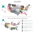
USA MAP vector graphic with Census regions interstates map pastel colours tone
Unveiling the West Coast Wonders A Detailed Map of California Oregon Washington and Surrounding Territories
Denton County Texas Comprehensive Aerial Road Map Unveiling Detailed Geographic Features and Infrastructure
A Stunning Aerial View of the Richmond Virginia Skyline at Night Intricate Cityscapes Illuminated Towers and Interstate
Comprehensive USA Aerial Map Detailed Network of Airports Interstates and Railroads for Seamless Looping Presentation
Map illustrating the United States, highlighting each state with incorrect
Pennsylvania Interstate Map
Tennessee State Interstate Map
New York State Road Map
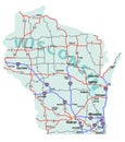
Wisconsin State Interstate Map
Next Page
←
↑
↓
→
See more images