Search
(+)
cartoon
dealer
buy stock illustrations
Home
My rookie portfolio
📷 Upload yours 🤳
Find results that contain
all
of your keywords. Content filter is
on
. Search will return
best illustrations, stock vectors and clipart
.
Exclude
Make it so!
You have chosen to exclude "
" from your results.
Choose orientation:
Related commercial searches:
photogrammetry
realistic
models
furniture
photographs
drone
capturing
vibrant
grassland
blooms
iot
powered
monitoring
protection
ghostly
sofa
multiple
exposure
rendered
wi
surface
scan
measurement
also
called
image
non
contact
methods
evaluation
Page
of 16
←
→
Order by:
relevancy of keywords
|
publishing date
|
most downloaded
Photogrammetry
Cartoons, Illustrations & Vector Stock Images
- 423 images
Photogrammetry Realistic D models of furniture from photographs
Drone Photogrammetry Capturing Vibrant Grassland Blooms for IoT Powered Monitoring and Protection
ghostly sofa multiple exposure photogrammetry a sofa rendered wi
photogrammetry or surface scan measurement, also called image measurement, non-contact measurement methods and evaluation methods
Drone Mapping concept with imaginary cadastral map of territory, land parcels and drone taking an aerial photogrammetry
Beyond the Gates of Heaven: A Breathtaking Photogrammetry Journe
3D Model building Mickey Bourke`s
3D Model banana showing wireframe
3D Model wooden chair showing wireframe
Scary Fish: A Photogrammetry Model With Expressive Facial Animation
Terrain digital elevation model
Aerial Orthorectified, Orthorectification Digital Elevation Model
Computer Vision - Conceptual Illustration
Satellite system for GPS orbiting the earth
flat remote sensing design
Breakthrough advancements in cerebral drones
Digital elevation model of mine for GIS usage
A satellite orbiting the earth
Geographic Information System
Digital elevation model piles of aggregates for GIS usage
Digital elevation model of mine with stockpiles
Map of elevation of a city urban area with roads and junctions for GIS and planning usage
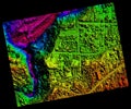
Elevation scan of a forest area with a meandering river
Geodetics engineering technology and equipment. Vector line art illustration
Geodesy measuring equipment banner set, engineering technology for land survey, geodesy, engineering
Geographic information systems, gis, cartography and mapping. Web mapping
Next Page
←
↑
↓
→
See more images