Search
(+)
cartoon
dealer
buy stock illustrations
Home
My rookie portfolio
📷 Upload yours 🤳
Find results that contain
all
of your keywords. Content filter is
on
. Search will return
best illustrations, stock vectors and clipart
.
Exclude
Make it so!
You have chosen to exclude "
" from your results.
Choose orientation:
Related commercial searches:
earth
fault
lines
tectonic
plates
plate
map
continental
ocean
pacific
volcano
lithosphere
geography
vector
illustration
nteractions
layers
concept
structure
soil
limestone
geology
world
planet
modern
continents
infographics
set
icons
flat
Page
of 248
←
→
Order by:
relevancy of keywords
|
publishing date
|
most downloaded
Tectonic
Cartoons, Illustrations & Vector Stock Images
- 6683 images
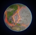
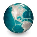
Earth's fault lines between tectonic plates
Tectonic plate earth map. Continental ocean pacific, volcano lithosphere geography plates
Vector illustration of a Tectonic plate ðnteractions
Layers of tectonic plates concept. Lithosphere and the structure of the earth. Soil and Limestone. Geography geology
Tectonic plate. Earth`s lithosphere. world map
Tectonic Plates on the planet Earth. modern continents and infographics Set of icons Flat style
Tectonic Plates on the planet Earth. modern continents and infographics Set of icons Flat style with scheme
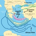
Aegean Sea Plate, also known as Aegean or Hellenic Plate, tectonic map
Map of the principal tectonic plates, 16 major pieces of the Earth
Principal tectonic plates, 16 major pieces of the Earth, gray map
Tectonic Plates on the planet Earth. modern continents and infographics Set of icons Flat style
Tectonic plates on Earth\'s surface
Tectonic plates on Earth\'s surface. World map with names of countries
Earthquake infographic. Destroyed buildings and fragmented street surrounded by plate tectonic shift data
Tectonic Plates on the planet Earth. modern continents and infographics Set of icons Flat style
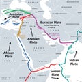
Arabian Plate, Arabian Peninsula minor tectonic plate, gray tectonic map
Principal tectonic plates of the Earth, world map
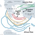
Aegean Sea Plate, also Aegean or Hellenic Plate, gray tectonic map
Tectonic plates on Earth\'s surface, centered by America continent
tectonic earthquake disaster icon color illustration
Mediterranean Basin, Middle East and North Africa, tectonic map
Tectonic plates on Earth\'s surface. World map with names of countries, continents, oceans, main seas and lakes
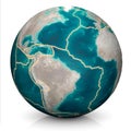
Tectonic plates move constantly, making new areas of ocean floor, building mountains, causing earthquakes, and creating volcanoes.
tectonic earthquake disaster line icon vector illustration
Tectonic plates move constantly, making new areas of ocean floor, building mountains, causing earthquakes, and creating volcanoes.
Tectonic Rift in Snowy Landscape.
Lava Erupts from Tectonic Fracture.
Next Page
←
↑
↓
→
See more images