Search
(+)
cartoon
dealer
buy stock illustrations
Home
My rookie portfolio
📷 Upload yours 🤳
Find results that contain
all
of your keywords. Content filter is
on
. Search will return
best illustrations, stock vectors and clipart
.
Exclude
Make it so!
You have chosen to exclude "
" from your results.
Choose orientation:
Related commercial searches:
vector
illustrated
map
south
africa
provinces
administrative
divisions
neighbouring
countries
political
largest
cities
borders
donkeys
enclosure
rietvlei
nature
reserve
gauteng
detailed
regions
states
division
capital
Page
of 9
←
→
Order by:
relevancy of keywords
|
publishing date
|
most downloaded
Gauteng
Cartoons, Illustrations & Vector Stock Images
- 235 images
Vector illustrated map of South Africa with provinces and administrative divisions, and neighbouring countries
Vector map of South Africa with provinces and administrative divisions
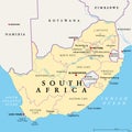
South Africa, political map with provinces, largest cities and borders
Donkeys in an enclosure, Rietvlei Nature Reserve, Gauteng, South Africa.
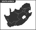
The detailed map of South Africa with regions or states. Administrative division
The detailed map of South Africa with regions or states and cities, capital. Administrative division
City of Johannesburg Metropolitan Municipality road, administrative and political map
Johannesburg stamp rubber grunge
The detailed map of South Africa with regions or states. Administrative division
Vector blank map of South Africa with provinces and administrative divisions
Union Buildings official residence of South African President
Drones mapping climate-sensitive regions
Watercolour illustration of South Africa Map Silhouette in blue color with artistic brush strokes and text lettering example.
Vector map of South Africa with provinces and administrative divisions
Vector blank map of South Africa with provinces and administrative divisions, and neighbouring countries
Vector blank map of South Africa with provinces and administrative divisions
Map of the administrative divisions of South Africa
Detailed vector map of Madre de Dios Island, Magallanes Region, Chile
South Africa higt detailed map with subdivisions
SOWETO
Map of South Africa in gray on a white background
Vector map of South Africa with provinces and administrative divisions, and neighbouring countries
Physical map of the world, satellite view of South Africa. Globe. Hemisphere. Reliefs and oceans
Next Page
←
↑
↓
→
See more images