Search
(+)
cartoon
dealer
buy stock illustrations
Home
My rookie portfolio
📷 Upload yours 🤳
Find results that contain
all
of your keywords. Content filter is
on
. Search will return
best illustrations, stock vectors and clipart
.
Exclude
Make it so!
You have chosen to exclude "
" from your results.
Choose orientation:
Related commercial searches:
asian
australia
oceania
vector
countries
maps
world
illustration
west
africa
territories
north
europe
infographic
central
south
america
southern
transparent
globe
planet
earth
metallic
silver
set
european
region
borders
Page
of 741
←
→
Order by:
relevancy of keywords
|
publishing date
|
most downloaded
Maps
Cartoons, Illustrations & Vector Stock Images
- 78492 images
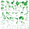
Asian, Australia and Oceania vector countries maps
World maps-Illustration-maps
West africa - maps of territories - vector
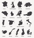
North europe - maps of territories - vector
Maps infographic
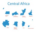
Central Africa - maps of territories - vector
South America Maps
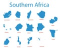
Southern africa - maps of territories - vector
Transparent world globe maps planet earth metallic silver set
Vector set of european maps with region borders
Hand drawn vector maps. Print for camping and outdoor activities
Low poly GPS pin on pc laptop screen. Maps and navigator services.
Maps and pin form lines, triangles and particle style design
Maps, location and navigation icon set with white background. Thin line style stock vector.
Earth set icons, Globes with World Maps, set Earth globe hemispheres with continents - vector
Spaceship and Earth with galaxy background UFO concept of alien spaceship planet Earth maps by NASA
Set of 3D Country Maps
Three 3D Globes with World Maps - vector
Infographic business design elements - vector illustration. Infograph template collection. World and USA maps. Industrial factory
Vector posters with highly detailed silhouettes of maps of the states of America, Division Pacific - Washington, Oregon,
Smartphone with maps icon
Vector posters with highly detailed silhouettes of maps of the states of America, Division West South Central - Arkansas,
Black silhouette maps of the twenty largest islands in the world
Maps pin. Location map black icon. Location pin. Pin icon vector. Communication, background.
Gps maps and navigation vector concepts set
Vector posters with highly detailed silhouettes of maps of the states of America, Division Mountain - Idaho, Montana, Wyoming -
Earth set 3D transparent Globes with World Maps, Earth globe hemispheres with continents - vector
Next Page
←
↑
↓
→
See more images