Search
(+)
cartoon
dealer
buy stock illustrations
Home
My rookie portfolio
📷 Upload yours 🤳
Find results that contain
all
of your keywords. Content filter is
on
. Search will return
best illustrations, stock vectors and clipart
.
Exclude
Make it so!
You have chosen to exclude "
" from your results.
Choose orientation:
Explore cartoons & images using related keywords:
atlantic
atlas
belfast
boyne
britain
british
celtic
channel
coastline
cork
corrib
country
craigavon
derg
derry
donegal
drogheda
dublin
dundalk
erne
foyle
galway
georges
great
ireland
irish
island
isles
kilkenny
kingdom
limerick
londonderry
lough
map
neagh
north
northern
ocean
political
ree
roscommon
saint
sea
shannon
tullamore
united
waterford
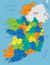
Ireland Political Map Cartoon Vector
Download
Designed by
Peterhermesfurian
Title
Ireland Political Map #103603005
Description
Ireland Political Map with capital Dublin, national borders, most important cities, rivers and lakes. English labeling and scaling. Illustration.
United Kingdom countries and Ireland political map
Northern Ireland political map
Northern Ireland Political Map
Ireland Political Sihouette Map
Colorful Ireland political map with clearly labeled, separated layers.
Ireland - political map, red country shape, borders
United Kingdom countries and Ireland political map. England, Scotland, Wales, Northern Ireland, Guernsey, Isle of Man
Ireland political map of administrative divisions
Ireland Political Map with capital Dublin, most important cities and national borders