Search
(+)
cartoon
dealer
buy stock illustrations
Home
My rookie portfolio
📷 Upload yours 🤳
Find results that contain
all
of your keywords. Content filter is
on
. Search will return
best illustrations, stock vectors and clipart
.
Exclude
Make it so!
You have chosen to exclude "
" from your results.
Choose orientation:
Explore cartoons & images using related keywords:
background
border
cartography
city
contour
country
design
dublin
europe
european
geography
graphic
gray
green
illustration
ireland
irish
isolated
map
maps
nation
national
outline
political
republic
shape
silhouette
state
symbol
territory
vector
white
world
Ireland Political Sihouette Map Cartoon Vector
Download
Designed by
Netsign33
Title
Ireland Political Sihouette Map #112498025
Description
Ireland Political Sihouette Map. Black and White Vector Graphic
United Kingdom countries and Ireland political map
Northern Ireland political map
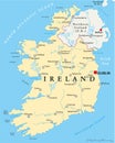
Ireland Political Map
Northern Ireland Political Map
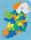
Colorful Ireland political map with clearly labeled, separated layers.
Ireland - political map, red country shape, borders
United Kingdom countries and Ireland political map. England, Scotland, Wales, Northern Ireland, Guernsey, Isle of Man
Ireland political map of administrative divisions