Search
(+)
cartoon
dealer
buy stock illustrations
Home
My rookie portfolio
📷 Upload yours 🤳
Find results that contain
all
of your keywords. Content filter is
on
. Search will return
best illustrations, stock vectors and clipart
.
Exclude
Make it so!
You have chosen to exclude "
" from your results.
Choose orientation:
Explore cartoons & images using related keywords:
administrative
area
association
authority
border
card
cards
cartography
centrum
circle
circles
cities
city
coal
construction
counties
country
county
district
districts
dortmund
dysentery
energy
facility
food
funds
geo
geography
german
germany
government
heavy
hierarchy
independent
industrial
industry
limit
management
map
maps
material
metropolis
north
population
pott
pride
regional
rhine
ruhr
site
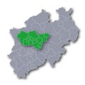
Map Of NRW Ruhr Area And Dortmund Vector Illustration
Download
Designed by
Ustod713
Title
Map of NRW Ruhr area and Dortmund #108329530
Description
Map NRW Ruhr area and the city of Dortmund
Map of North Rhine-Westphalia and Ruhr area
Oberhausen City Skyline. Germany, Ruhr Area. Solid color.
Flag of Duisburg in North Rhine-Westphalia of Germany
Flag of Oberhausen in North Rhine-Westphalia of Germany
Coat of arms of Oberhausen in North Rhine-Westphalia, Germany
Flag of Oberhausen in North Rhine-Westphalia, Germany
Coat of arms of Castrop-Rauxel in North Rhine-Westphalia, Germany
Flag of Castrop-Rauxel in North Rhine-Westphalia, Germany
Flag of Recklinghausen in North Rhine-Westphalia, Germany
vector map of the largest German metropolitan region, the Ruhr area
Street Art, Graffiti under Freeway Bridge at Duisburg, Inner Harbor. North Rhine-Westphalia , Germany
Florian Tower, Westfalenpark, Dortmund, Ruhr Area, NRW, Germany 220 meter high illustration
Dortmund Center for Medicine & Health DOC Dortmund, Germany