Search
(+)
cartoon
dealer
buy stock illustrations
Home
My rookie portfolio
📷 Upload yours 🤳
Find results that contain
all
of your keywords. Content filter is
on
. Search will return
best illustrations, stock vectors and clipart
.
Exclude
Make it so!
You have chosen to exclude "
" from your results.
Choose orientation:
Explore cartoons & images using related keywords:
20mm
aerial
aero
agua
amazon
america
banos
beautiful
best
birds
del
destination
diablo
drone
ecuador
eye
forest
geodesy
grass
green
jungle
land
landscape
mosaic
multirotor
national
natural
nature
orthorectification
orthorectified
outside
pailon
pastaza
photogrammetry
professional
quadcopter
rio
river
santa
scenery
scenic
south
stream
stunning
summer
surveying
technology
terrain
tool
tourism
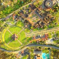
Orthorectified Drone Aerial Map Stock Photo
Download
Designed by
Ammit
Title
Orthorectified Drone Aerial Map #114324486
Description
Orthorectified Drone Aerial Map Used In Photogrammetry
Orthorectified aerial image
Mitad Del Mundo Quito Drone Aerial Overview
City Center Of The World Quito Ecuador Aerial
Virgen Del Panecillo Quito Aerial Overview
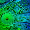
High Resolution Orthorectified, Orthorectification Aerial Map Used For Photogrammetry
San Martin Canyon Banos De Agua Santa
High Resolution Orthorectified, Orthorectification Aerial Map Used For Photogrammetry
High Altitude Volcano Crater View
High Resolution Orthorectified, Orthorectification Aerial Map Used For Photogrammetry
Digital Elevation Model Representing Geological Anomalies
Digital altitude model orthorectified aerial top view drone