Search
(+)
cartoon
dealer
buy stock illustrations
Home
My rookie portfolio
📷 Upload yours 🤳
Find results that contain
all
of your keywords. Content filter is
on
. Search will return
stock photos and royalty free images
.
Exclude
Make it so!
You have chosen to exclude "
" from your results.
Choose orientation:
Related commercial searches:
high
resolution
orthorectified
orthorectification
aerial
map
used
photogrammetry
satellite
mapping
concept
imaginary
territory
land
parcels
geodetic
taking
surveyor
protective
mask
prepares
quadcopter
Page
of 12
←
→
Order by:
relevancy of keywords
|
publishing date
|
most downloaded
Photogrammetry
Stock Photos, Royalty-Free Images
- 299 images
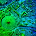
High Resolution Orthorectified, Orthorectification Aerial Map Used For Photogrammetry
SATELLITE MAPPING CONCEPT with imaginary map of territory, land parcels and geodetic satellite taking an aerial photogrammetry
Surveyor in a protective mask prepares a quadcopter for photogrammetry
Grey Photogrammetry Tool with Graduated Metering
a person flying a kite on a cloudy day, in style of photogrammetry cloud
San Martin Canyon Banos De Agua Santa
Orthorectified Drone Aerial Map
SATELLITE MAPPING CONCEPT with imaginary rural map of territory, land parcels and geodetic satellite
Surveyor in a protective mask prepares a quadcopter for flying around an object
Surveyor caught a quadrocopter
Pocket stereoscope near the aerial photograph
A man holds a quadrocopter and a control panel
A man in a protective mask holds a quadrocopter and a control panel
A man holds a quadrocopter
Quadrocopter on stand
Detail shot of a 3D model of a mechanical object showcasing the realistic textures and materials created through
High Resolution Aerial Digital Elevation Model
High Resolution Digital Elevation Model Of A Water Dam
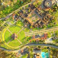
Orthorectified aerial image
Virgen Del Panecillo Quito Aerial Overview
Orthorectified aerial image
Mitad Del Mundo Quito Drone Aerial Overview
City Center Of The World Quito Ecuador Aerial
Panecillo Hill And Park Quito Ecuador Drone Aerial Shot
Next Page
←
↑
↓
→
See more images