Search
(+)
cartoon
dealer
buy stock illustrations
Home
My rookie portfolio
📷 Upload yours 🤳
Find results that contain
all
of your keywords. Content filter is
on
. Search will return
best illustrations, stock vectors and clipart
.
Exclude
Make it so!
You have chosen to exclude "
" from your results.
Choose orientation:
Explore cartoons & images using related keywords:
america
american
background
canada
chicago
cities
color
country
dakota
decoration
design
divisions
geography
graphic
great
icon
illinois
illustration
indiana
interstate
iowa
kansas
lakes
map
michigan
midwest
midwestern
minnesota
mississippi
missouri
nebraska
north
ohio
region
regions
rivers
road
south
states
travel
united
usa
vector
wisconsin
Map Of The Midwest United States Of America Vector Illustration
Download
Designed by
Lesniewski
Title
Map of the Midwest United States of America #147800834
Description
Map of the Midwest United States of America.
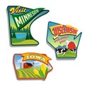
Midwest United States Minnesota Wisconsin Iowa illustrations designs
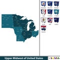
Upper Midwest of United States
Illustrated pictorial map of Midwest United States.
Map of the Midwest United States of America
United States, Census regions and divisions, political map
Map of United States split into Census regions and divisions
Welcome to Indiana Rusted Street Sign
U.S. state of Michigan, subdivided into 83 counties, gray political map
Michigan, U.S. state, subdivided into 83 counties, multi colored map
Wisconsin, U.S. state, subdivided into 72 counties, multi colored map
State of Michigan divided into counties, outline map