Search
(+)
cartoon
dealer
buy stock illustrations
Home
Black Friday
Find results that contain
all
of your keywords. Content filter is
on
. Search will return
stock photos and royalty free images
.
Exclude
Make it so!
You have chosen to exclude "
" from your results.
Choose orientation:
Explore cartoons & images using related keywords:
administrative
background
border
borderline
caen
channel
cherbourg
cities
coast
commune
county
detailed
district
europe
france
french
geography
graphic
havre
illustration
islands
language
map
michel
mont
motorway
new
norman
normandie
normandy
outline
plan
political
province
region
river
road
rouen
saint
seine
state
subdivision
territory
town
travel
vector
white
Road Map Of The New French Region Of Normandy In French Language Vector Illustration
Download
Designed by
Lesniewski
Title
Road map of the new French region of Normandy in French language #149990518
Description
Road map of the new French region of Normandy in French language.
Road map of french riviera, france
Road map of the french mediterranean island corsica
Road map of the French overseas territory of Wallis and Futuna
Road map New Caledonia French island group in the South Pacific
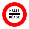
Halt toll road sign in french language
Road sign for internet city label in french language
Flooded road sign in French language
Road closed sign in French language
Modified circulation road sign in French language
Aerial overhead view of semi-trailer truck with MADE IN FRANCE text driving along the road. French business related 3D
Road sign with French writing `stimulus plan`
Vector road map of the island of Moorea in French Polynesia
Retirement home road sign called ehpad in french language
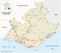
Road map of the French region of Provence-Alpes-Cote d Azur