Search
(+)
cartoon
dealer
buy stock illustrations
Home
My rookie portfolio
📷 Upload yours 🤳
Find results that contain
all
of your keywords. Content filter is
on
. Search will return
best illustrations, stock vectors and clipart
.
Exclude
Make it so!
You have chosen to exclude "
" from your results.
Choose orientation:
Explore cartoons & images using related keywords:
separatism
occupied
lnr
lpr
dnr
dpr
republic
people
oblast
war
russian
russia
donbas
map
luhansk
region
river
ukraine
administrative
area
azov
blue
border
capital
cartography
cities
city
country
donbass
donets
east
eps
europe
geographic
geographical
geography
illustration
land
light
lugansk
mariupol
political
province
sea
state
territory
ukrainian
Political Map Of Ukraine With Borders Of The Regions. Template For Your Design Cartoon Vector
Download
Designed by
Grebeshkovmaxim
Title
Political map of Ukraine with borders of the regions. template for your design #242276839
Description
Political map of Ukraine with borders of the regions. Vector illustration
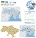
Ukraine maps with markers
Isolated dotted political map of Ukraine
Highly detailed editable political map with separated layers. Ukraine.
Waving Political Ukraine Flag - Mosaic with Raised Voting Arms
Political map of Ukraine in blue and yellow color
Political Map of Ukraine
Empty Political Map of Ukraine
Lublin Triangle, political map, Lithuania, Poland and Ukraine alliance
Political map of Ukraine with borders
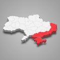
3d Political map of Ukraine with borders
Political map of Ukraine 2024 with borders of the regions