Search
(+)
cartoon
dealer
buy stock illustrations
Home
My rookie portfolio
📷 Upload yours 🤳
Find results that contain
all
of your keywords. Content filter is
on
. Search will return
stock photos and royalty free images
.
Exclude
Make it so!
You have chosen to exclude "
" from your results.
Choose orientation:
Explore cartoons & images using related keywords:
administrative
aland
area
atlas
background
border
borders
business
communication
concept
connection
contour
country
county
detailed
digital
district
dot
emblem
europe
european
global
glow
information
islands
line
map
mesh
modern
nation
national
network
outline
patriotism
political
poly
polygon
polygonal
region
regional
state
territory
wallpaper
world
Map Of Aland Islands, Polygonal Mesh Line Map Royalty-Free Stock Photo
Download
Designed by
Allexxandar
Title
Map of Aland Islands, Polygonal mesh line map #247047651
Description
Map of Aland Islands, Polygonal mesh line map, modern colorful map
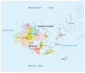
Aland islands administrative and political map
Modern Map - Aland Islands Finland FI
Aland Islands region watercolor map of Finland in front of a white background
Map of Europe - Aland Islands
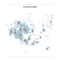
Aland Islands map vector with red pin.
Map of North Atlantic Ocean - Aland Islands
Map of Europe - Aland Islands with Finland
Aland Islands red highlighted in map of Finland
Coat of Arms of Aland Islands
Map of Europe - Aland Islands with Finland
Aland Islands map
Blank map of Aland Islands. High quality map Aland Islandswith provinces on transparent background for your web site design, logo,
Map of Aland Islands, Gold glitter map
Map of Aland Islands, financial success
Map of Scandinavia - Aland Islands