Search
(+)
cartoon
dealer
buy stock illustrations
Home
My rookie portfolio
📷 Upload yours 🤳
Find results that contain
all
of your keywords. Content filter is
on
. Search will return
best illustrations, stock vectors and clipart
.
Exclude
Make it so!
You have chosen to exclude "
" from your results.
Choose orientation:
Explore cartoons & images using related keywords:
diagram
line
font
text
brand
drawing
screenshot
presentation
design
map
circle
document
cartoon
sketch
pattern
plan
poster
advertising
state
census
tracts
boundaries
2020
pennsylvania
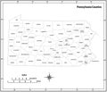
US Pennsylvania State Map With Census Tracts Boundaries Vector Illustration
Download
Designed by
Vectormaps
Title
US Pennsylvania State Map with Census Tracts Boundaries #280072544
Description
Pennsylvania State map with Census Tracts Boundaries of 2020
Pennsylvania State by counties
Pennsylvania State Capitol in Harrisburg
Map of the U.S. state of Pennsylvania
Hand Drawn Pennsylvania State Design
Pennsylvania state outline administrative and political vector map in black and white
Pennsylvania State Highway road sign
Vector Ruffed Grouse - Pennsylvania State Bird
Pennsylvania state USA map glowing silhouette made of stars lines dots, low polygonal shapes.
Doodle vector map of Pennsylvania state of USA
Pennsylvania state detailed editable map
3d Map of Pennsylvania state with color. United State of America, US, United State