Search
(+)
cartoon
dealer
buy stock illustrations
Home
My rookie portfolio
📷 Upload yours 🤳
Find results that contain
all
of your keywords. Content filter is
on
. Search will return
best illustrations, stock vectors and clipart
.
Exclude
Make it so!
You have chosen to exclude "
" from your results.
Choose orientation:
Explore cartoons & images using related keywords:
country
map
vector
political
continent
globe
cartography
business
global
illustration
earth
silhouette
geography
state
border
continental
land
nation
travel
world
graphic
ortographic
planet
design
simplified
round
projection
elegance
administrative
detailed
worldwide
politic
yellow
orange
gold
dark
gray
label
name
labeling
australia
australian
oceania
polynesia
papua
indonesia
fiji
vanuatu
solomon
Political Map Of Australia Vector Illustration
Download
Designed by
Pytyczech
Title
Political map of Australia #305871840
Description
Political map of Australia. Blue colored land with country name labels on white background. Ortographic projection. Vector illustration
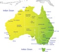
Political map of Australia
Australia maps with markers
Empty Political Map of Australia
Map of World. Political map divided to six continents - North America, South America, Africa, Europe, Asia and Australia
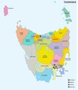
Administrative and political map of the 29 Local government areas of Tasmania, Australia
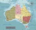
Detailed Australia Political map in Mercator projection. Clearly labeled. Separated layers.
Oceania, political map, Australia and the Pacific, including New Zealand
Oceania, gray political map, Australia and the Pacific, including New Zealand
Isometric political map of Eurasia and Australia
Isometric political map of Australia