Search
(+)
cartoon
dealer
buy stock illustrations
Home
My rookie portfolio
📷 Upload yours 🤳
Find results that contain
all
of your keywords. Content filter is
on
. Search will return
best illustrations, stock vectors and clipart
.
Exclude
Make it so!
You have chosen to exclude "
" from your results.
Choose orientation:
Explore cartoons & images using related keywords:
administrative
amsterdam
atlas
bitmap
blue
borders
boundaries
boundary
cartography
chart
color
colorful
community
continent
contour
country
district
districts
drawing
drenthe
dutch
eec
euro
europe
european
flag
flevoland
friesland
gelderland
geography
gradient
graphic
groningen
holland
icon
icons
illustration
limburg
map
maps
nation
national
nations
netherlands
northbrabant
northholland
outline
overijssel
province
provinces
Netherlands Provinces Maps Cartoon Vector
Download
Designed by
Lavinia4000
Title
Netherlands provinces maps #31381273
Description
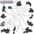
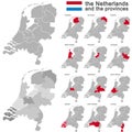
A set of netherlands provinces maps icons
the Netherlands and provinces
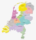
Netherlands administrative map
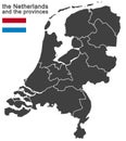
the Netherlands and provinces
Netherlands Provinces Flags Set
Netherlands provinces map
Map of Netherlands with the 12 provinces a hexagon tile mosaic in
Vector regional map of Netherlands with provinces, Caribbean special municipalities and administrative divisions
Vector regional blank map of Netherlands with provinces, Caribbean special municipalities and administrative divisions
Vector regional map of Netherlands with provinces, Caribbean special municipalities and administrative divisions.
Vector regional blank map of Netherlands with provinces, Caribbean special municipalities and administrative divisions.
Vector regional map of Netherlands with provinces, Caribbean special municipalities and administrative divisions.
Vector regional blank map of Netherlands with provinces, Caribbean special municipalities and administrative divisions.
Vector illustrated regional map of Netherlands with provinces, Caribbean special municipalities and administrative divisions