Find results that contain all of your keywords. Content filter is on.
Search will return best illustrations, stock vectors and clipart.
Choose orientation:
Make it so!
You have chosen to exclude "" from your results.
Choose orientation:
Explore cartoons & images using related keywords:
america
american
americans
appalachian
atlantic
atlas
border
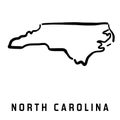
carolinian chapel charlotte chart charting cities city civil coast columbus duke durham east eps fayetteville forest georgia goldsboro great greensboro greenville heel henderson hill illustration jacksonville kannapolis kentucky lake land map mapping miles mitchell mountain mountains national native new north ocean park peakNorth Carolina Map Vector Illustration
Designed by
Title
North Carolina Map #36422152
Description


