Search
(+)
cartoon
dealer
buy stock illustrations
Home
Black Friday
Find results that contain
all
of your keywords. Content filter is
on
. Search will return
best illustrations, stock vectors and clipart
.
Exclude
Make it so!
You have chosen to exclude "
" from your results.
Choose orientation:
Explore cartoons & images using related keywords:
america
antigua
azur
bahamas
barbados
barbuda
belize
blue
business
capital
central
cities
city
colombia
color
computer
continent
costa
cuba
detailed
dominica
dominican
equipment
geographical
grenada
guatemala
guyana
haiti
honduras
icon
icons
illustration
interface
jamaica
kitts
label
land
locations
lucia
map
mexico
navigational
navis
nicaragua
north
painting
panama
politics
puerto
regions
Central America - Map And Navigation Icons - Illustration. Cartoon Vector
Download
Designed by
Dikobrazik
Title
Central America - map and navigation icons - illustration. #59011807
Description
Central America map - highly detailed vector illustration.
Flags of Central America countries
Map Of Central America
Central America - map and navigation labels - illustration.
Map of Central America region with blue highlighted central american states. Country name labels. Simple flat vector
Central America and Caribbean Islands physical map
Doodle Map of Central America and Mexico
Political map of Central America and Mexico in four shades of green. Simple thin black outline vector illustration
Blank political map of Central America and Mexico. Simple thin black outline vector illustration
Central America and the Caribbean map
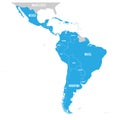
Political map of Latin America. Latin american states blue highlighted in the map of South America, Central America and
Caribbean islands Central America map Black blackboard separate states individual
Caribbean islands Central America map state names card colors 3D
Caribbean islands Central America map, new political detailed map, separate individual states, with state names, isolated on white