Search
(+)
cartoon
dealer
buy stock illustrations
Home
My rookie portfolio
📷 Upload yours 🤳
Find results that contain
all
of your keywords. Content filter is
on
. Search will return
best illustrations, stock vectors and clipart
.
Exclude
Make it so!
You have chosen to exclude "
" from your results.
Choose orientation:
Explore cartoons & images using related keywords:
administration
america
billings
border
borders
bozeman
brown
butte
cities
city
colored
counties
county
falls
flag
great
havre
helena
illustration
island
islands
kalispell
laurel
lewistown
livingston
map
miles
missoula
montana
nation
outline
political
state
states
united
usa
vector
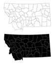
Montana County Map Vector Illustration
Download
Designed by
Malachy96
Title
Montana County Map #61563420
Description
A large and detailed map of the State of Montana with all counties and main cities.
Vector illustration of a county state with US united states flag
Montana County Map
Montana county map
Montana county map
Montana county maps
Blaine County, Montana U.S. county, United States of America, USA, U.S., US map vector illustration, scribble sketch Blaine map
Big Horn County, Montana U.S. county, United States of America, USA, U.S., US map vector illustration, scribble sketch Big Horn
Carbon County, Montana U.S. county, United States of America, USA, U.S., US map vector illustration, scribble sketch Carbon map
Cascade County, Montana U.S. county, United States of America, USA, U.S., US map vector illustration, scribble sketch Cascade
Custer County, Montana U.S. county, United States of America, USA, U.S., US map vector illustration, scribble sketch Custer map
Dawson County, Montana U.S. county, United States of America, USA, U.S., US map vector illustration, scribble sketch Dawson map
Chouteau County, Montana U.S. county, United States of America, USA, U.S., US map vector illustration, scribble sketch Chouteau
Makoshika State Park with Rock Formations in Dawson County Montana USA WPA Poster Art
US Montana county map