Search
(+)
cartoon
dealer
buy stock illustrations
Home
My rookie portfolio
📷 Upload yours 🤳
Find results that contain
all
of your keywords. Content filter is
on
. Search will return
best illustrations, stock vectors and clipart
.
Exclude
Make it so!
You have chosen to exclude "
" from your results.
Choose orientation:
Explore cartoons & images using related keywords:
africa
america
asia
australia
boundary
canada
cartography
china
city
colored
continent
country
detailed
equipment
europe
france
geography
germany
global
green
grid
highly
illustration
italy
japan
locations
map
multicolored
name
navigation
oceania
pacific
political
purple
red
region
russia
spain
travel
usa
vector
world
yellow
zealand
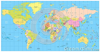
Detailed Political World Map: Countries, Cities, Water Objects Cartoon Vector
Download
Designed by
Pomogayev
Title
Detailed political World Map: countries, cities, water objects #73371301
Description
Detailed political World Map: countries, cities, water objects. All elements are separated in editable layers clearly labeled.
Highly detailed political world map
Detailed political map of Northern Africa and the Middle East an
Detailed Political World map
Detailed political world map with capitals, rivers and lakes
Large detailed political World Map and water objects
Large detailed political World Map with water objects
Large detailed vintage color political World Map with lakes and
Vector high detailed political world map
Highly detailed political World map with labeling
World Map Detailed Political Map
Political World map in Mercator projection.
World Map Political and Flags - Vector Detailed Illustration
All world continents detailed political isolated maps with names of countries, seas, oceans
All world continents detailed political isolated maps in grey scale color palette with names of countries, seas, oceans