Find results that contain all of your keywords. Content filter is on.
Search will return best illustrations, stock vectors and clipart.
Choose orientation:
Make it so!
You have chosen to exclude "" from your results.
Choose orientation:
Explore cartoons & images using related keywords:
albania
atlas
background
bathymetry
blank
blue
border
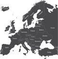
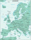
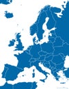
boundaries colorful continent contour country detailed element europe european france geography german germany graphic greece highly illustration italian italy kingdom lithuania map national poland politic political republic sea shape spain territory text travel turkey ukraine unitedEurope Political Map And Bathymetry Vector Illustration
Designed by
Title
Europe Political Map and Bathymetry #99400082
Description


